I travelled to the Canadian Rocky Mountains in late July and early August, flying through Edmonton, Alberta, and staying in Jasper, Alberta. The main idea for the fieldwork was to reinvestigate the Lower Ordovician section from which Dean (1989) described a sequence of crackout trilobite faunas coeval with those we are studying in the Great Basin. The hope was that we might be able to add a third main region to support the emerging sequence stratigraphic interpretations of faunal distributions.
The Rockies take some beating as a place to do fieldwork. The section was at Wilcox Pass, opposite the Columbia Icefields and the Athabasca Glacier. Access is by a trail leading steeply up from the back of the Parks Canada Columbia Icefields campground. Earlier reconnaissance with Steve Westrop indicated that there was an apparently nearly completely exposed section of the interval in question proceeding up the ridge crest of Wilcox Peak. Dean elected to measure and collect his section in the heavily vegetated region of the pass.
So up I went.
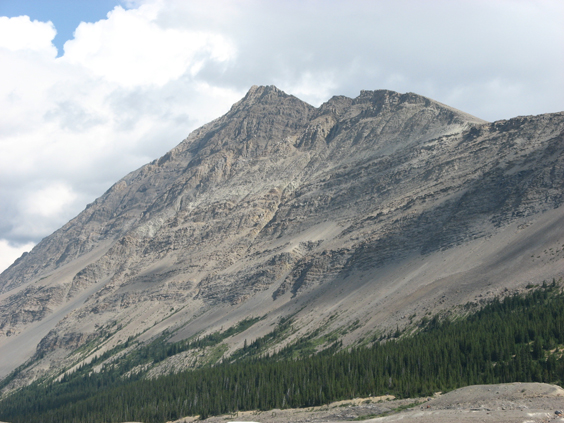
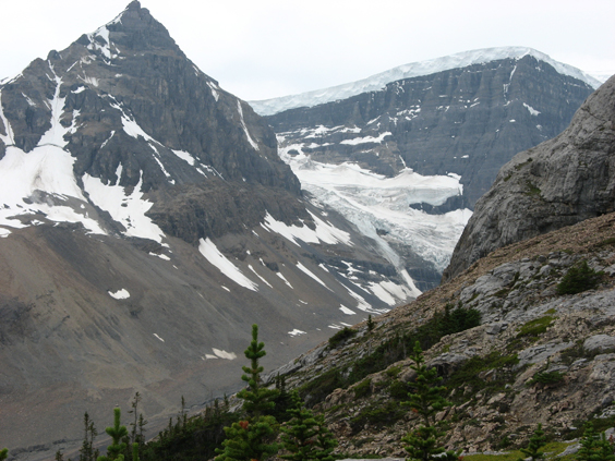
View of Wilcox Peak from across the valley. Wilcox Pass is over the top to the right.
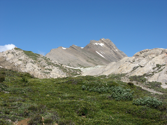
View of Wilcox Peak on the ascent from the campground.
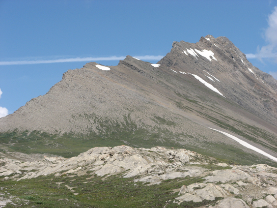
A bit closer. The prospective new section runs straight up the crest of the ridge.
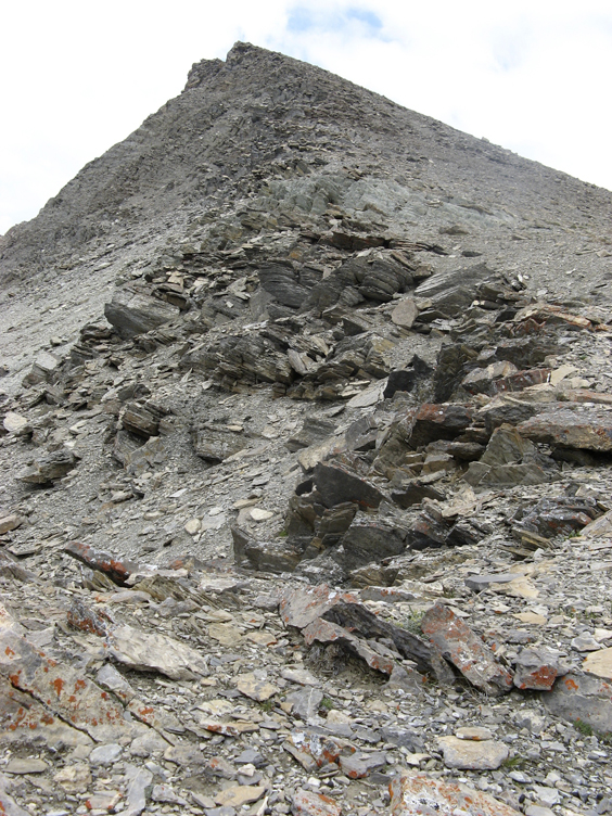
View straight up from around the Cambrian-Ordovician boundary at the base of the proposed section.
Sadly, the whole thing was pretty much a bust. The rocks down around the base of the section were nicely exposed. But higher on the ridge in the Lower Ordovician interval of interest, they were extremely heavily weathered. Following Dean's section down in the pass revealed not a great deal of exposure and lots of ancient hammer marks and holes where whatever crackout samples available had already mostly been removed. It certainly doesn't appear possible to get anything remotely like the kind of sampling we're getting in the Great Basin out of these rocks.
All was not entirely lost, however. Following Dean's section into the lower Skoki Formation, I stopped in my tracks. Silicified asaphids sticking out of the rocks, all over the place. Huh? There has never been any reports of silciified faunas in this section. But as I examined lump after lump, it was plain that there was abundant material of reasonably well silicified Floian trilobites. The only worry was that the rocks were dolomitic and didn't appear to be weathering very much. This gave me some concern that they would refuse to break down in acid. Nevertheless I took several packloads down the mountain. (postscript in 2013: the rocks broke down and yielded a somewhat coarsely silicified but definitely describable/publishable fauna dominated by two species of asaphids).
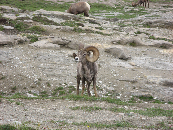
Bighorn sheep near Dean's line of section in Wilcox Pass.
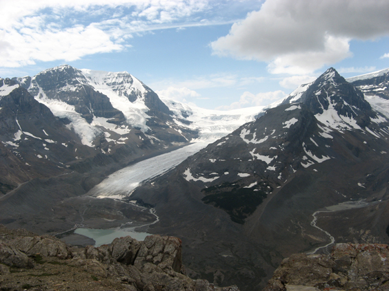
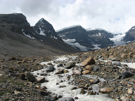
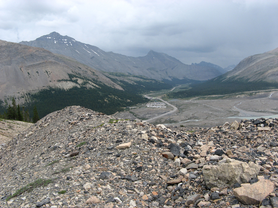
View across the valley from the base of Wilcox Peak. The large glacier to the left is Athabasca Glacier. The valley and meltstream to the right is below Dome Glacier.
With time on my hands given the failure of the original plan, I went to the alternative locality I had brought information on in case something like this happened. Years ago when I was a graduate student at the University of Alberta, Mike Caldwell had brought me to a Middle Cambrian locality across the valley he had discovered while climbing/hiking. The locality was in the Stephen Formation and featured abundant articulated trilobites. Mike had kindly sent me a rough map and instructions to remind me how to get back.
It wasn't easy when I was 26, and it really wasn't easy now. One parks at the main Athabasca Glacier parking lot near the toe of the glacier. The glacier, like most glacies, is retreating rapidly, and since I visited the locality the first time all those years ago, there is now a substantial meltwater lake to navigate around. One then has to wade the main Athabasca Glacier meltwater stream, cross over to the adjacent valley of Dome Glacier, wade that meltwater stream, climb Dome Glacier's lateral moraine up onto the flank of the mountain, then basically walk straight up to where the Stephen Formation is in outcrop. The trick with the meltwater streams is that they're bad early in the morning, but much worse coming back with a pack of rock late in the afternoon, when the sun has been melting the glacier all day.
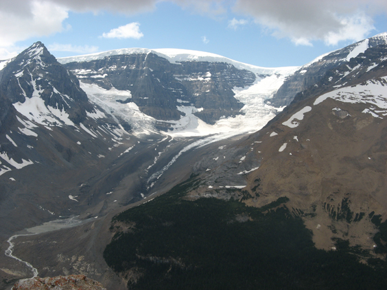
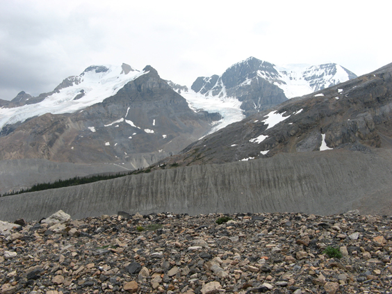
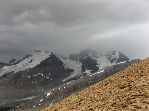
View panned north a bit from the preceding shot, looking up toward Dome Glacier. The Stephen Formation locality is about two thirds the way up the orangey rocks.
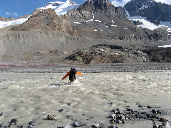
Crossing the Athabasca Glacier meltwater stream (bad words being uttered).
Dome Glacier valley and meltwater stream.
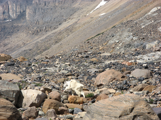
Rocky Mountain Goat in Dome Glacier valley.
View from top of Dome Glacier northern lateral moraine, toward southern lateral moraine.
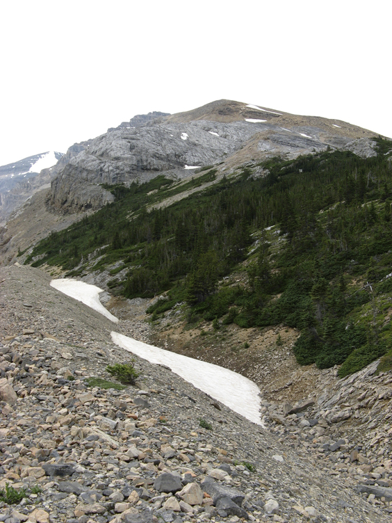
View toward the locality from the lateral moraine. The route proceeds through the woods, then up through the pale gray rocks into the orange-weathering Stephen Formation. It doesn't look as steep as it really is due to foreshortening. It's really steep.
View towards the Icefields Chalet and south down the parkway from the lateral moraine.
Ascending through the top of the woods.
And up above the treeline onto the Stephen Formation. Just in time…to get soaked with rain.
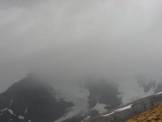
Wheee!!
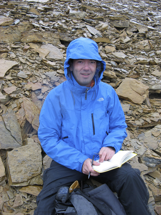
Writing in the rain…in a Rite In The Rain notebook.
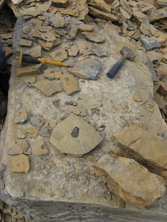
But at least there are lots of lovely articulated Middle Cambrian trilobites.
The trilobite fauna is only moderately diverse, but the outstretched silicified trilobites are beautifully preserved (aside from being flattened and crushed a bit). This project is now well advanced, with finished plates.